Darkocean opens NAVBathy Analysis Studio: offshore geotechnical analysis tied to the map
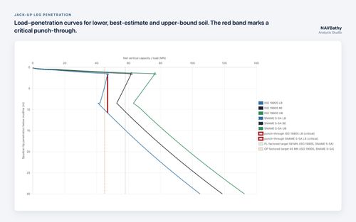
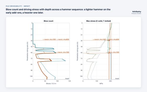
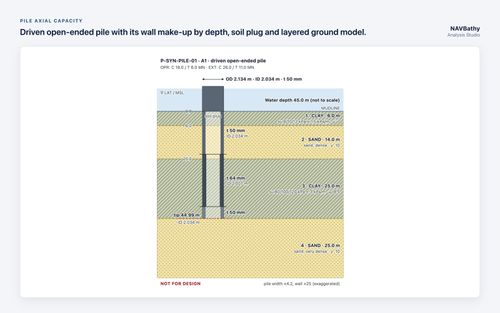
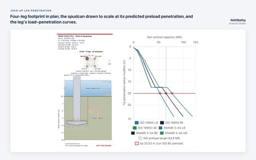
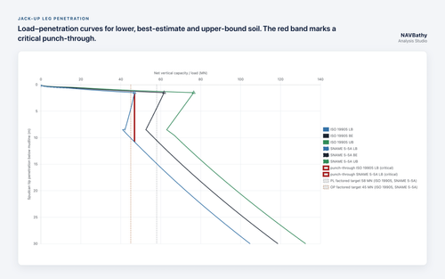
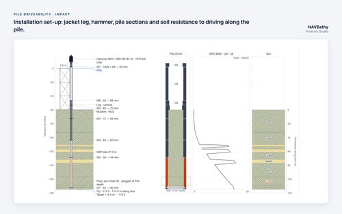
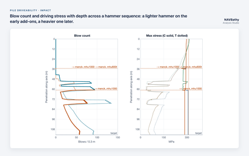
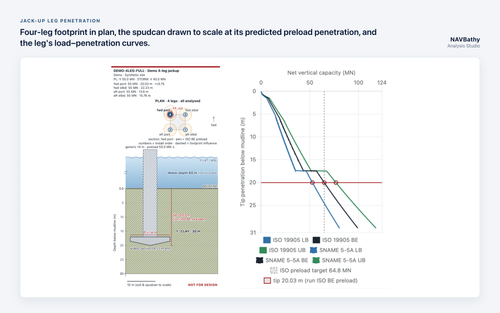
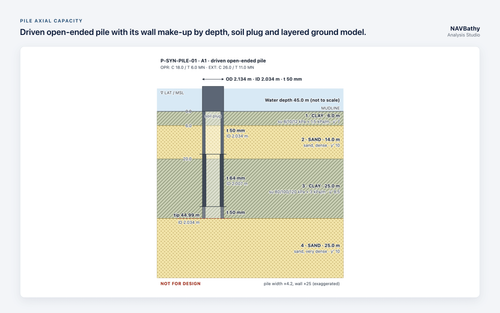
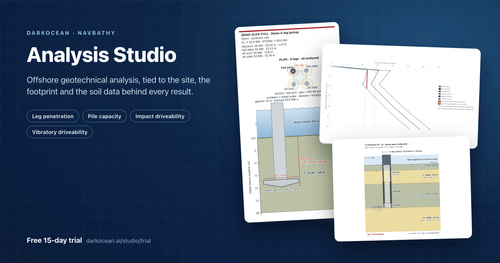
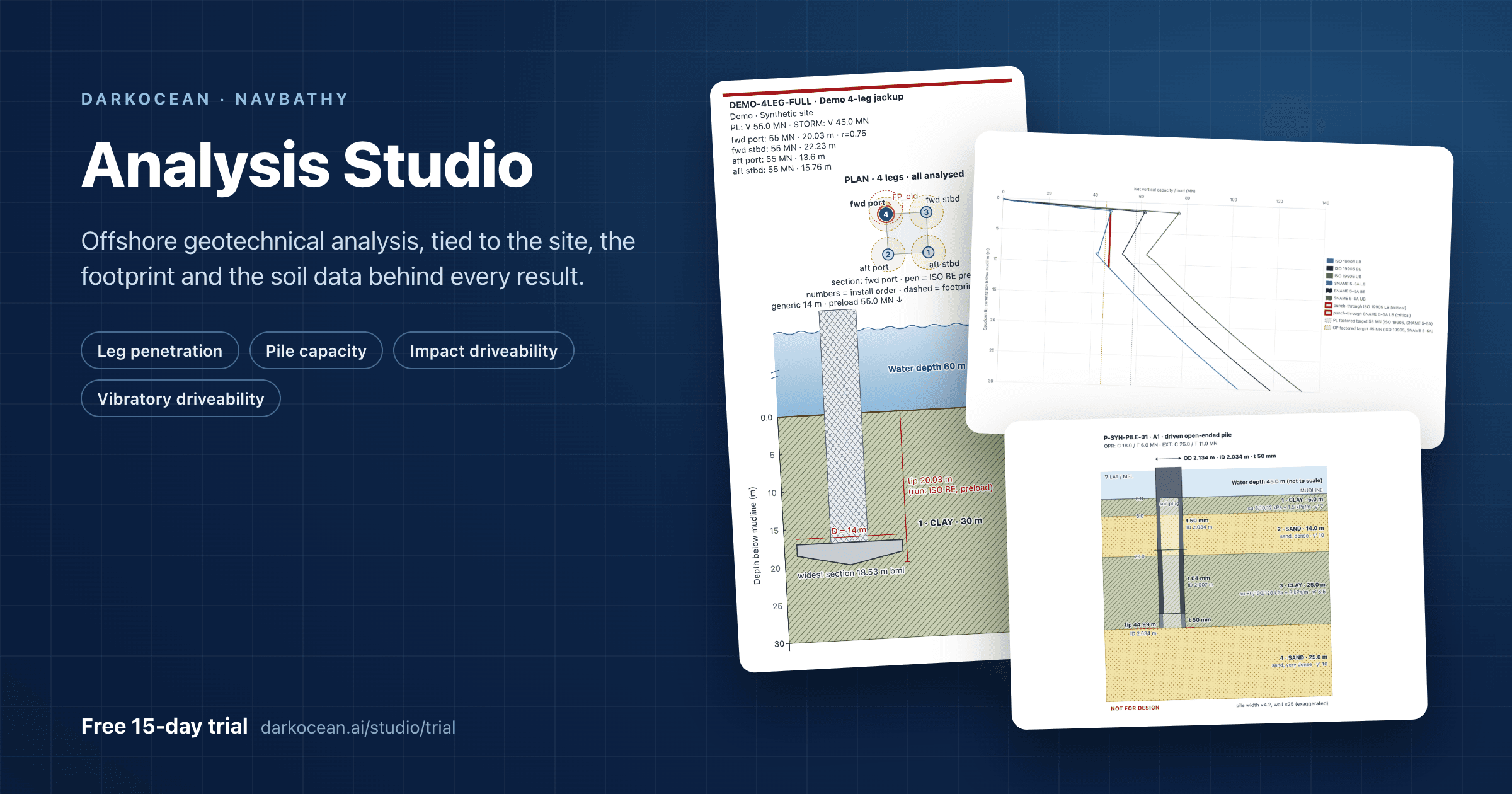
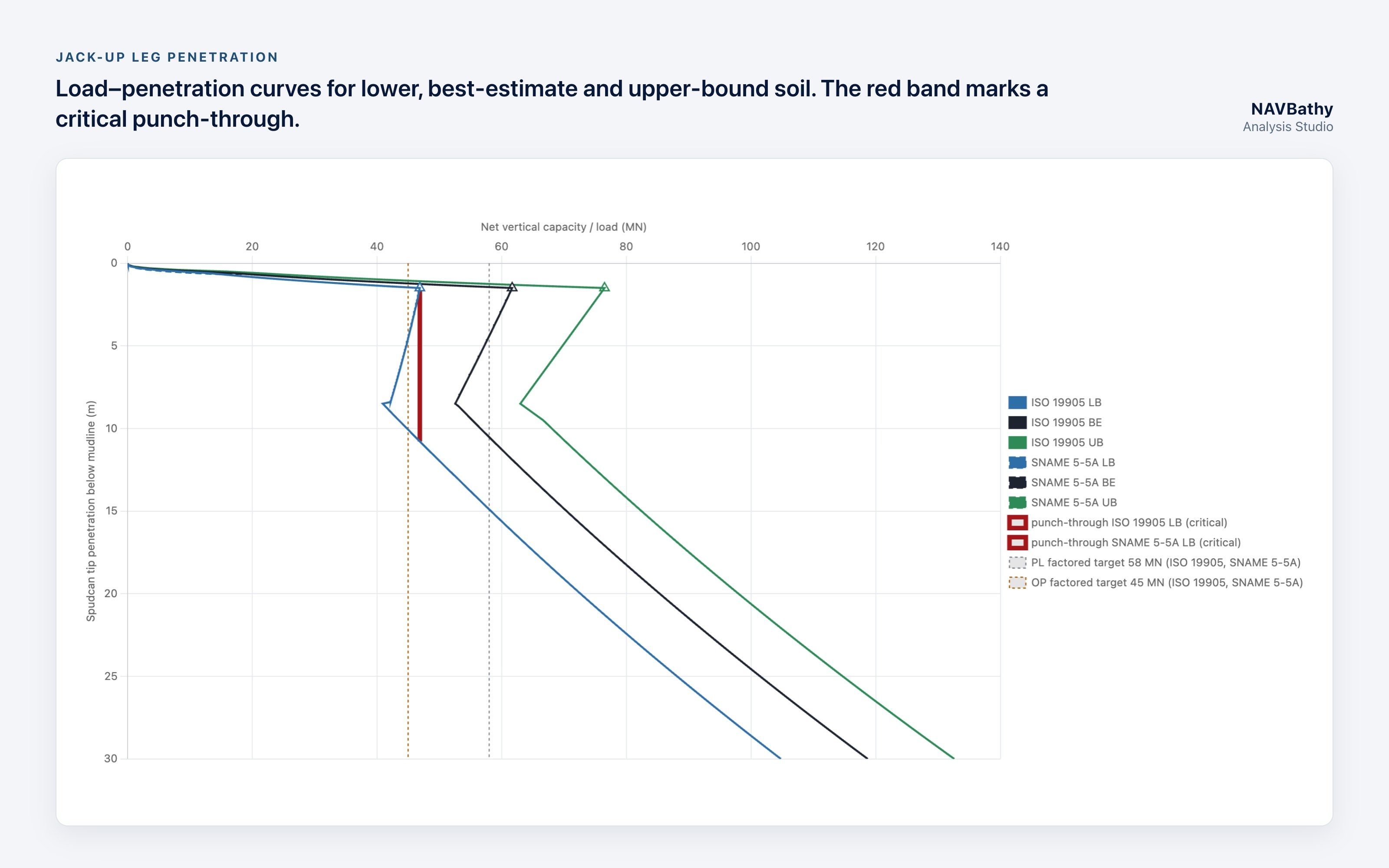
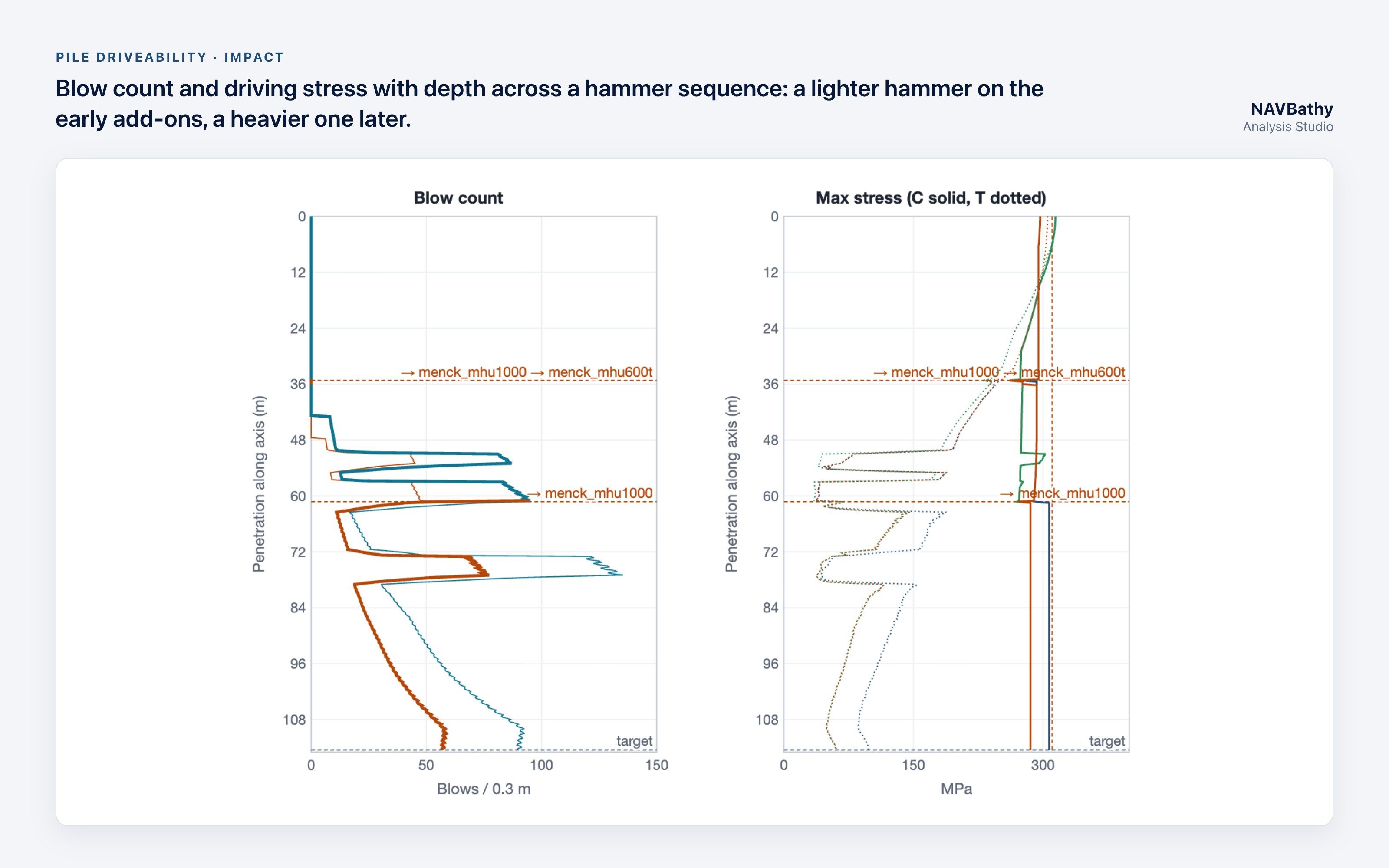
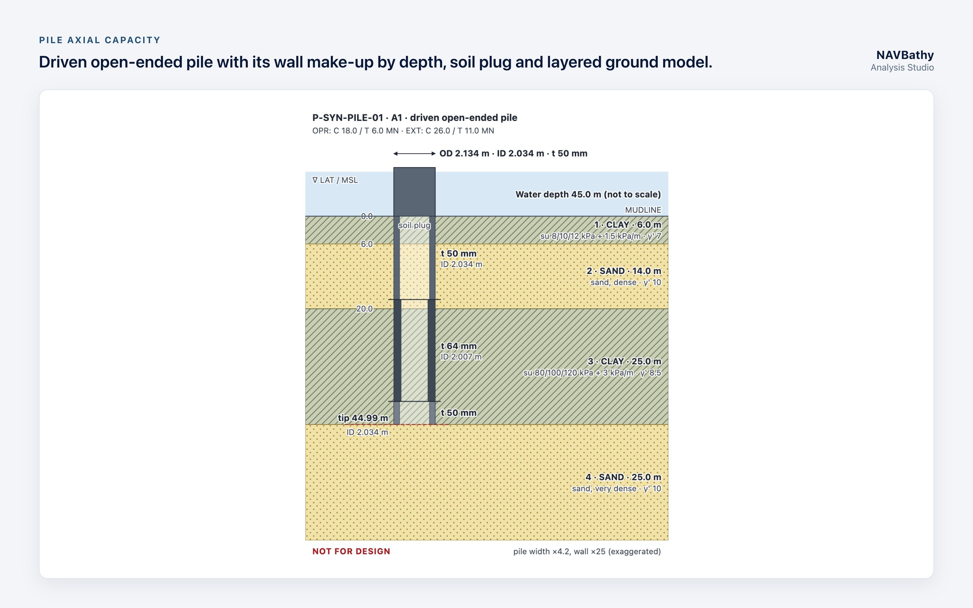
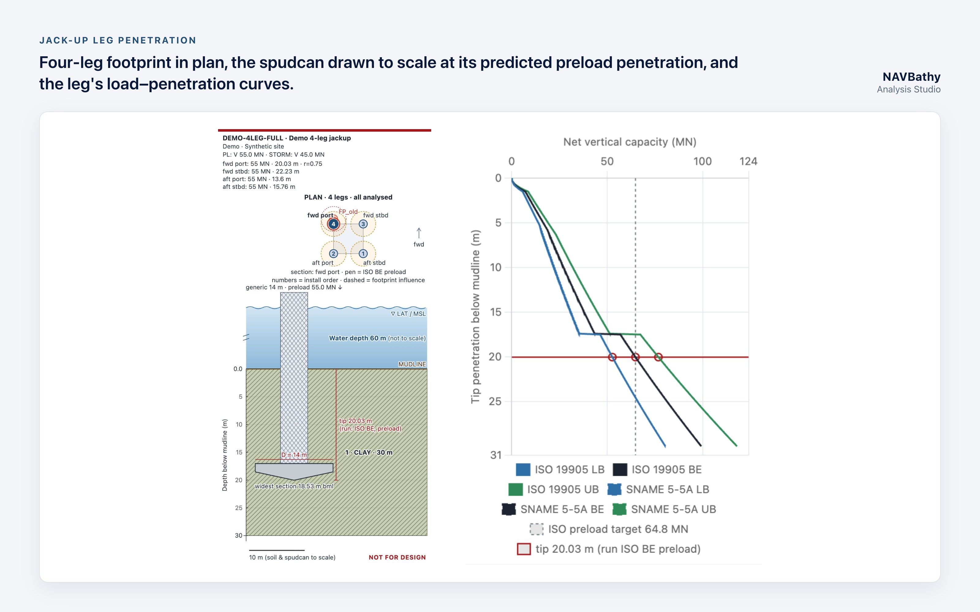
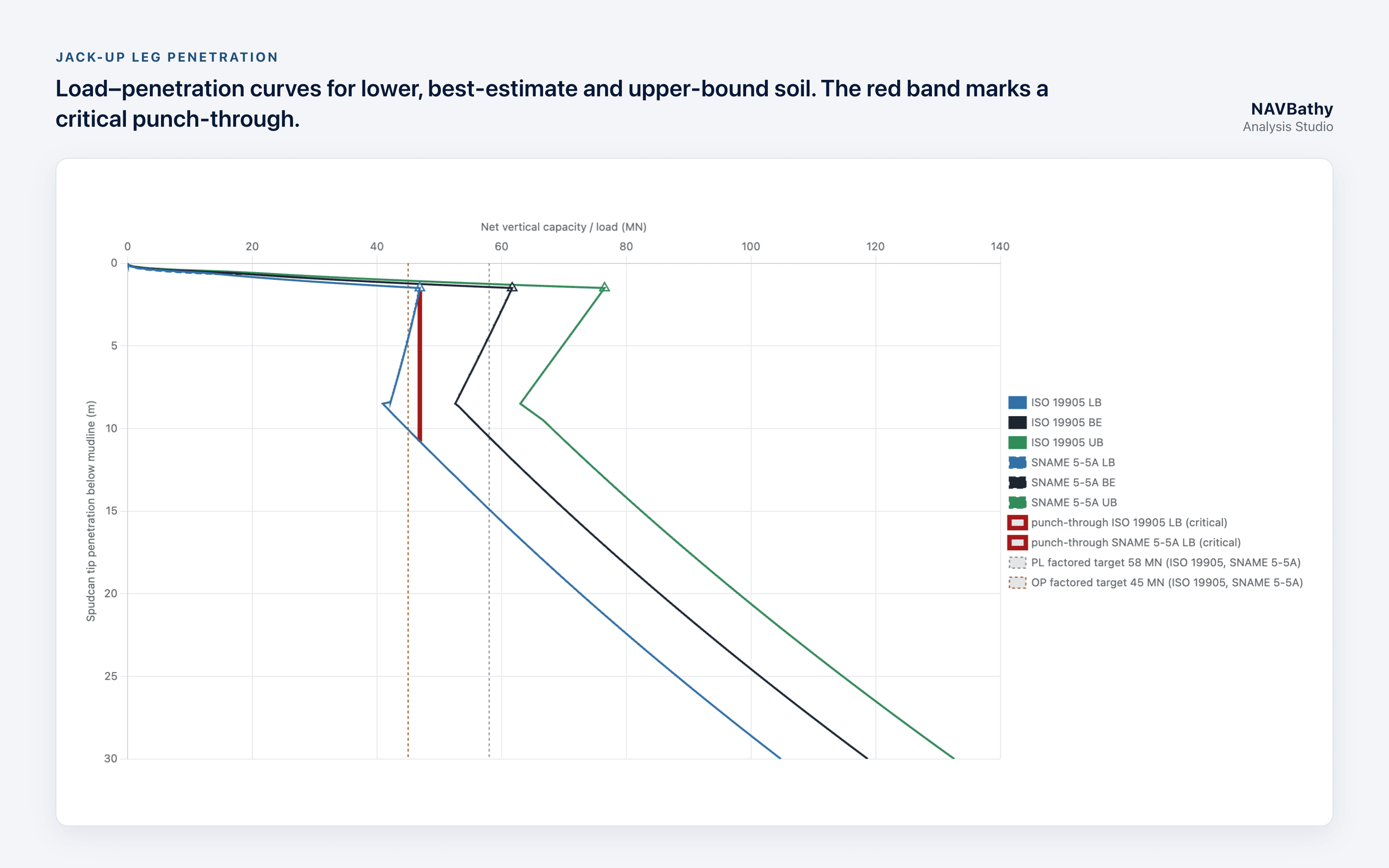
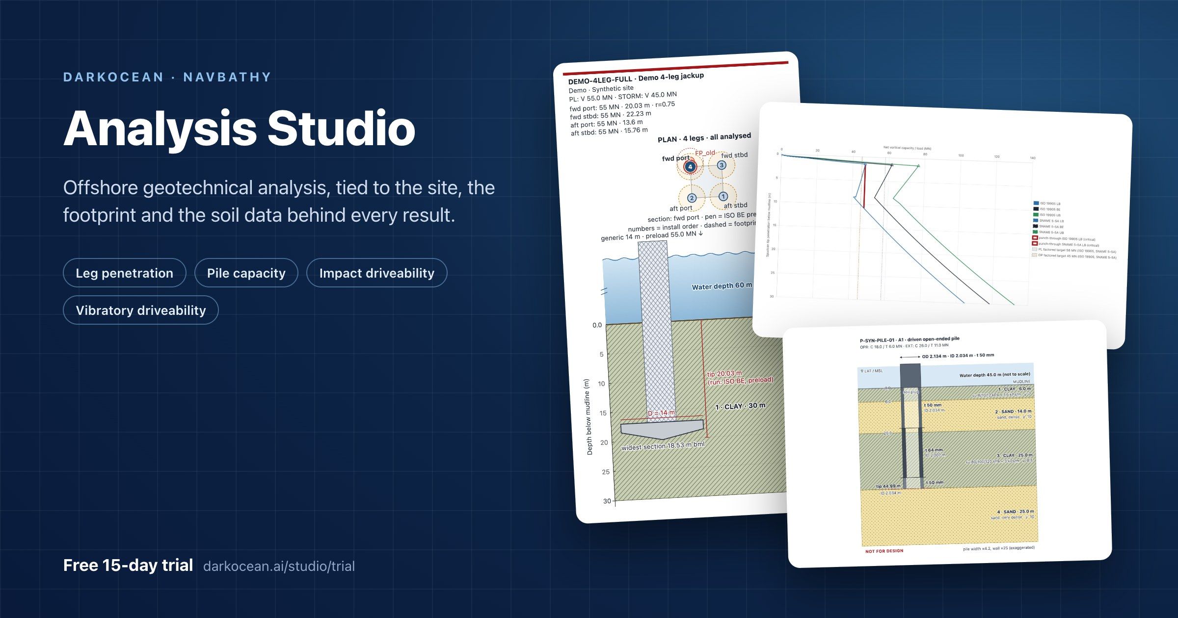
Leg penetration, pile capacity and pile driveability (impact and vibratory) now run in one browser workspace, built around the site, the structure footprint and the soil data behind every result. A free 15-day trial is open now.
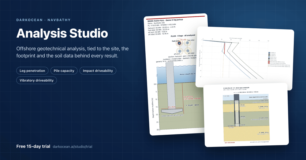
DOHA, Qatar, 11 November 2026 – Darkocean today opened NAVBathy Analysis Studio, a set of four offshore geotechnical engineering tools inside its NAVBathy marine data platform. Engineers place a site, lay out a jack-up or jacket footprint, attach borehole and CPT data, and run each analysis at a specific leg or pile. Every result shows how far it sits from the soil data it was built on.
Why it matters
Offshore foundation checks are usually split across desktop programs, spreadsheets and PDF borehole logs. The link between a result and the soil data behind it, or the leg it applies to, often lives only in the engineer's notes.
Analysis Studio keeps that link in the project. The site, the structure, the ground model and each analysis sit in one place, so a reviewer can see what was run, where, and on which data.
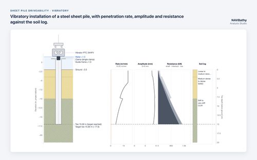
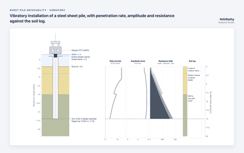
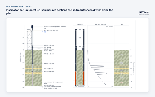
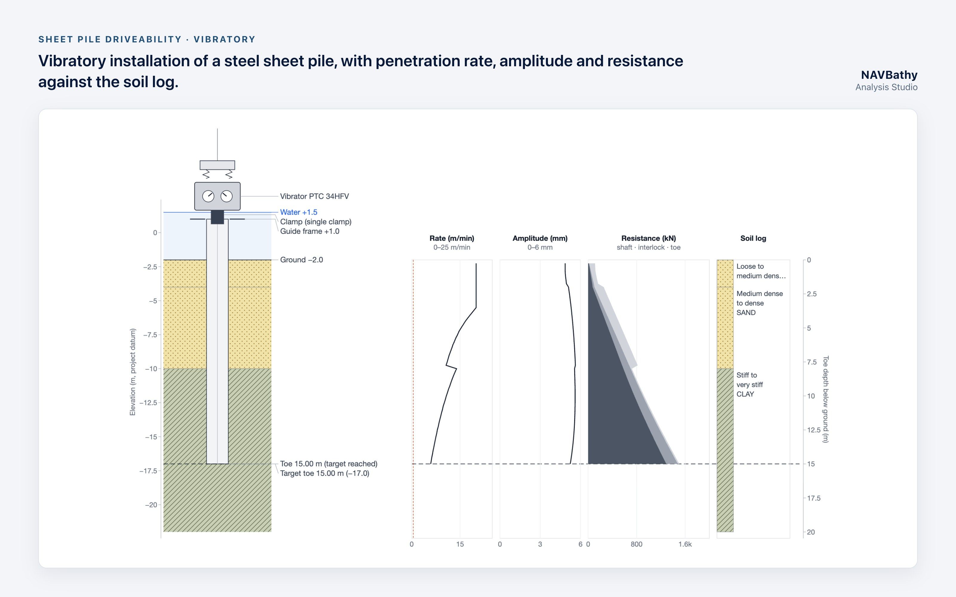
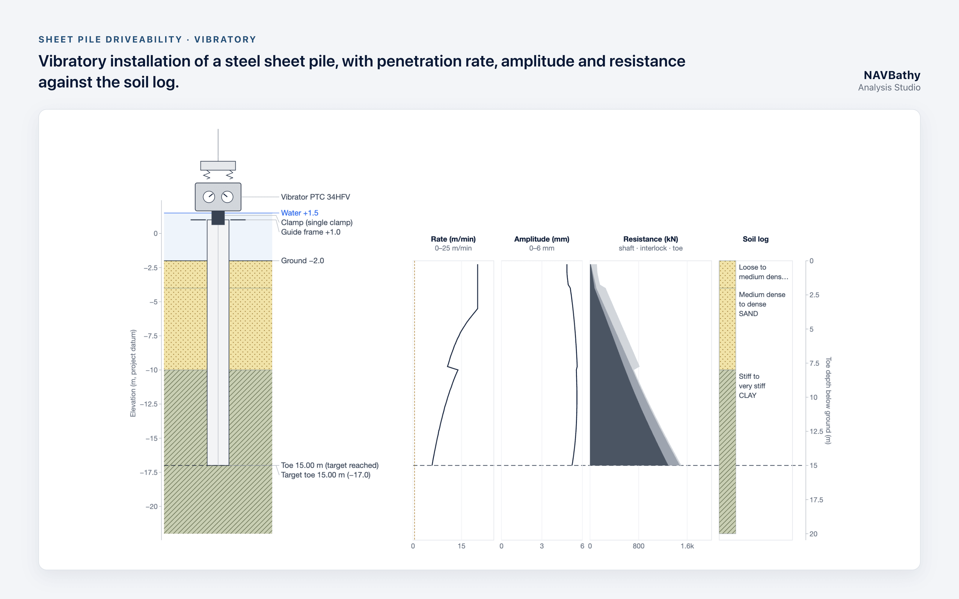
170 sheet pile sections and 20 vibratory hammers; penetration rate and refusal by depth
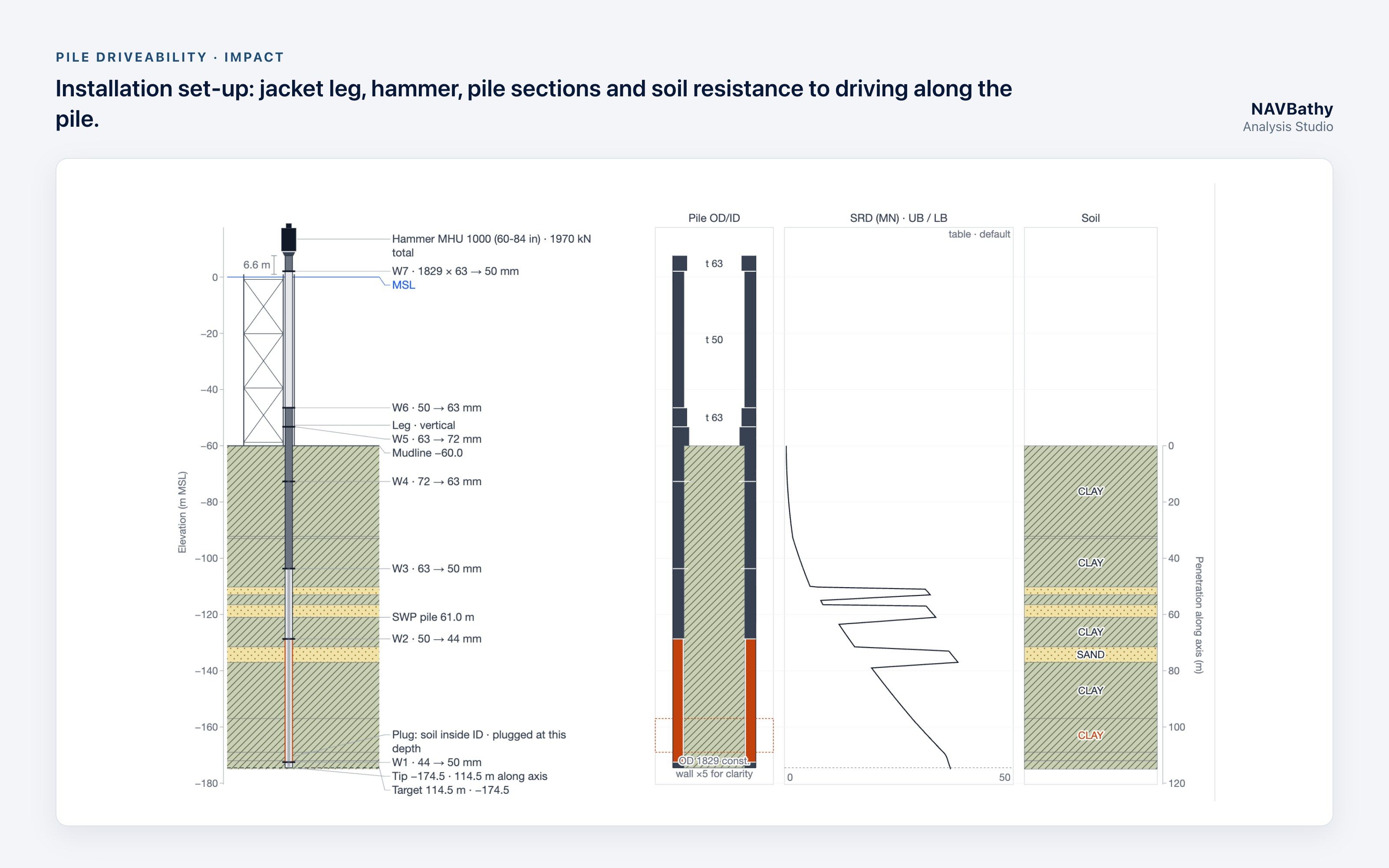
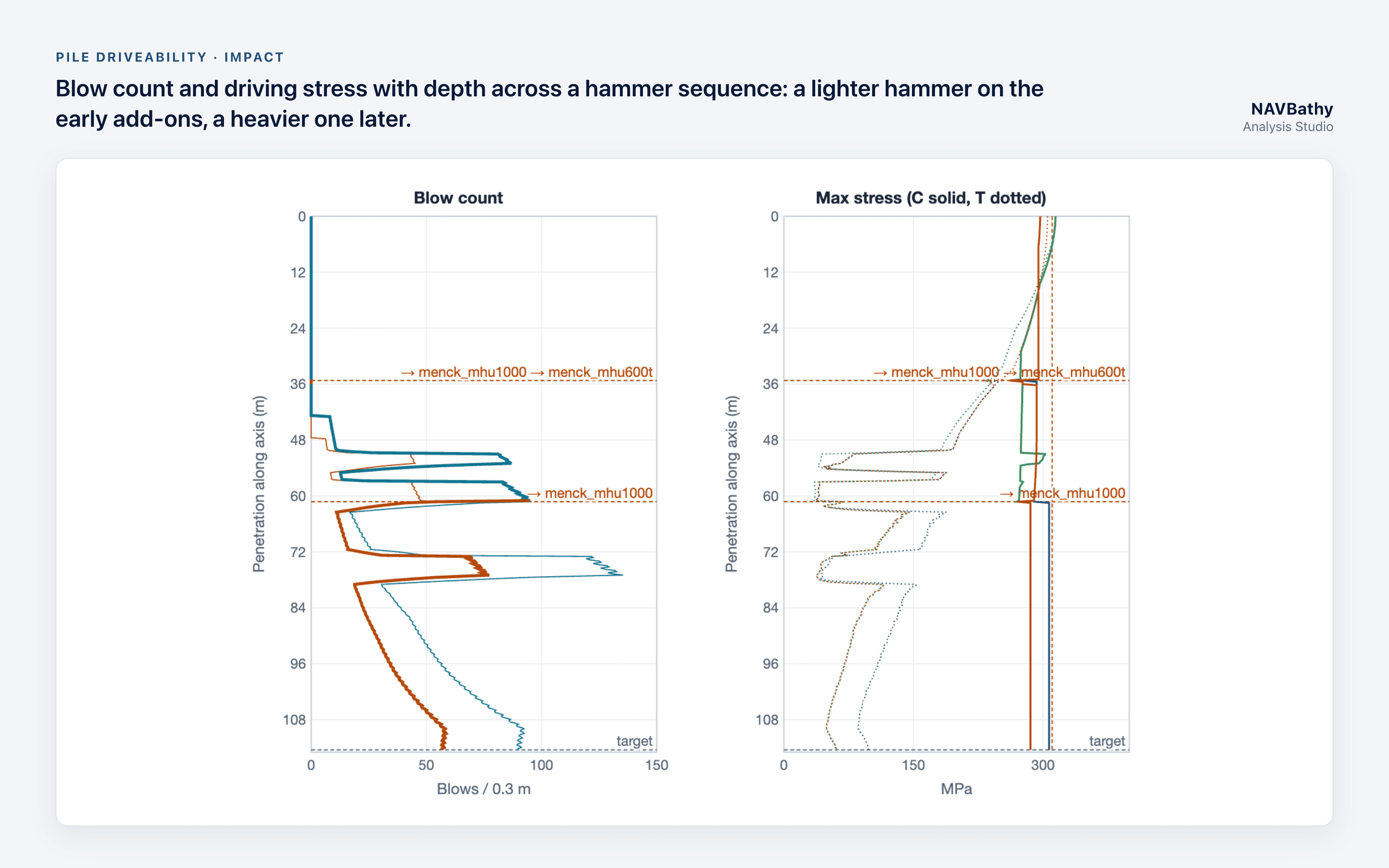
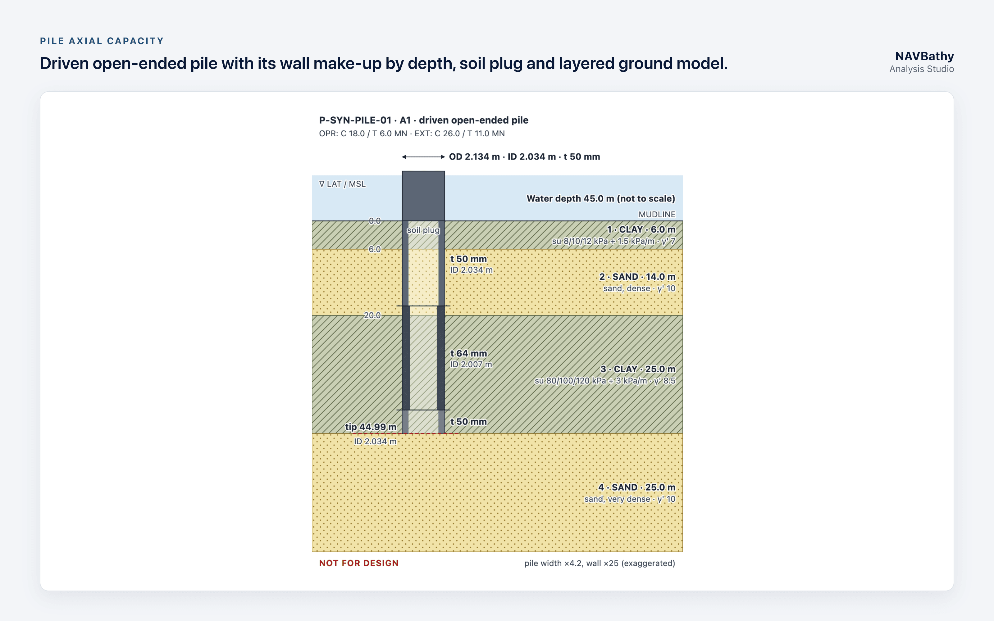
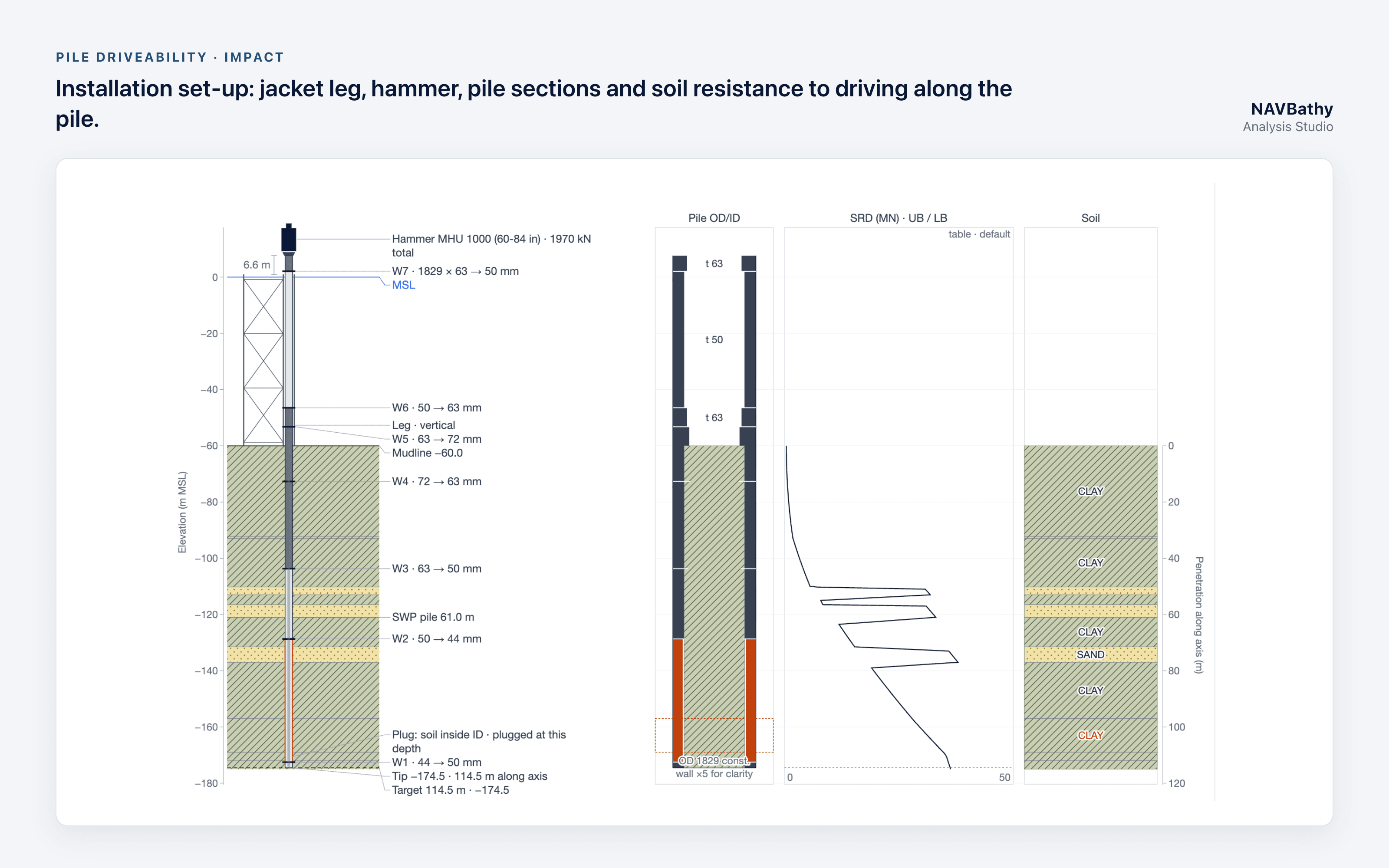
The four tools share one soil description and one look. Soil from a pile capacity run can feed the driveability analysis directly. Each run is stored with a fingerprint of its inputs and settings, so it can be repeated exactly.
Built on the map, not beside it
Analysis Studio runs inside NAVBathy, the same platform Darkocean uses for satellite-derived bathymetry and survey data. The workflow follows how a site is actually planned:
1. Site. Place a wind turbine, platform or wellhead location by easting and northing.
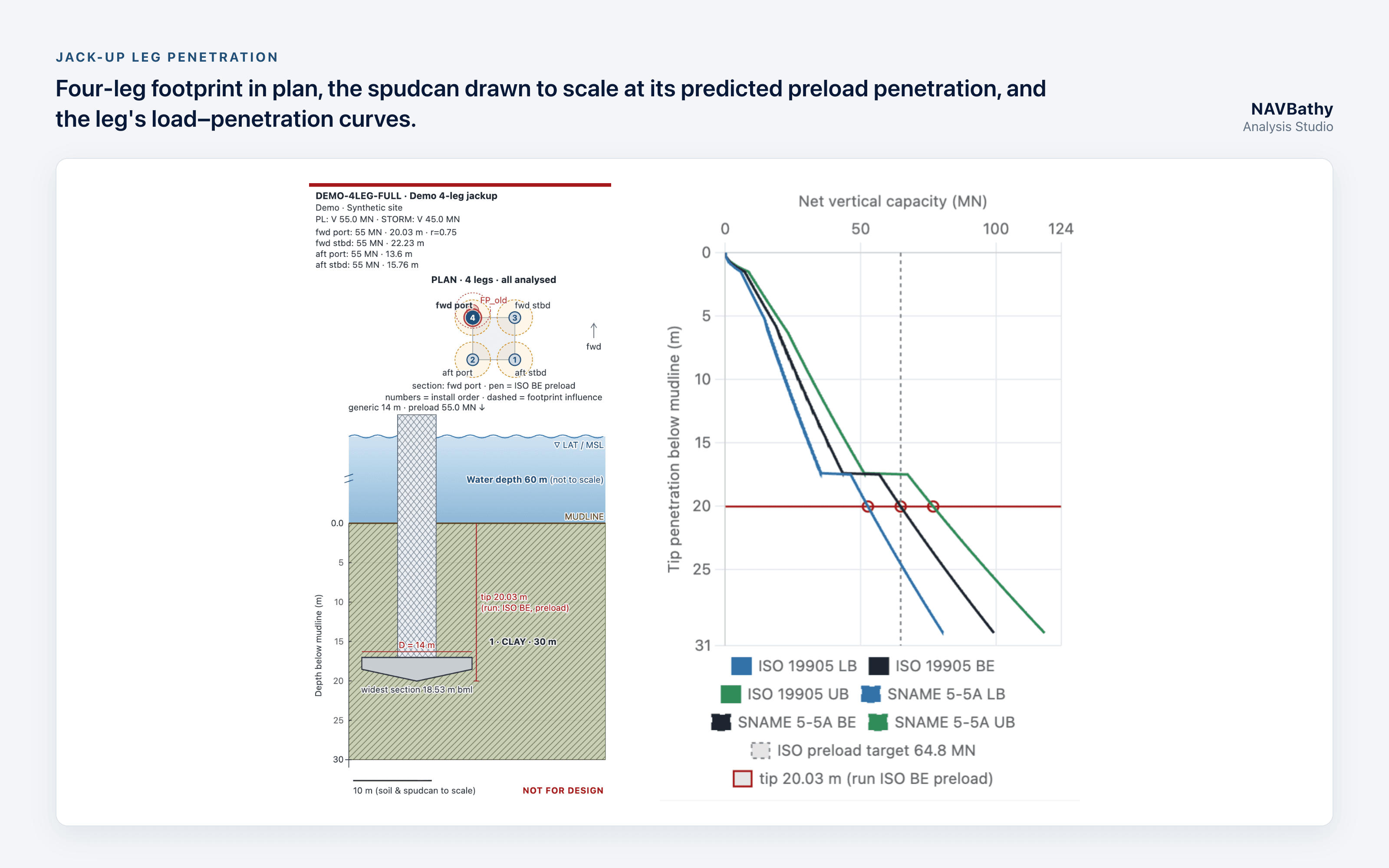
2. Footprint. Lay out a jacket with its main or skirt piles, or any number of jack-ups, each set by a reference leg and heading.
3. Ground model. Load a versioned master soil profile with borehole and CPT locations, and assign it, or an override, to each leg.
4. Analysis. Run leg penetration, capacity or driveability at a named leg or pile.
The distance from each leg or pile to its nearest borehole or CPT is shown in the Studio, in the report and on the map. Darkocean discloses that distance rather than scoring it, leaving the judgement to the engineer.
What Darkocean says
“Geotechnical results are only as good as the soil data behind them and the leg or pile they apply to. We built Analysis Studio so that link is never lost. You see the site, the structure, the borehole and the answer together, and you can always see how far the nearest data point is,” said Anupam Thakur, CEO, Darkocean.
“We want offshore engineers to try it on real projects and tell us what is missing. That is why the trial is free and open now,” he added.
Availability
A free 15-day trial is open now at darkocean.ai/studio/trial. Places are limited, and there is one trial per email address. Trial users get their own sites on the NAVBathy map and full use of all four tools; report and file export are disabled during the trial.
The Studio is aimed at offshore wind, oil and gas, subsea cable, jack-up operations, and port and coastal teams. For commercial access or a guided demonstration, contact commercial@darkocean.biz.
Note to editors: Analysis Studio is in evaluation release. Results are for assessment of the software and are not yet verified for design, construction or installation decisions.
###