

AI satellite-derived bathymetry for shallow water mapping
Shallow-water depth maps from satellite imagery, with no vessel and no mobilisation.
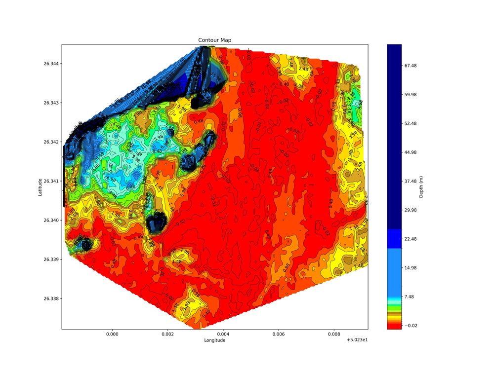
Satellite-derived bathymetry (SDB) estimates seabed depth from how sunlight is absorbed and scattered in clear, shallow water. NAVBathy, a Darkocean AI product, applies machine learning to multi-date Sentinel-2 and Landsat imagery to produce depth grids anywhere the satellites have looked. It suits scouting, planning and screening work before any boat goes out.
Limited by water clarity and light penetration
Set by the Sentinel-2 pixel size
Remote, desk-based workflow
Tide-corrected, with tide models
What is AI satellite-derived bathymetry?
Light entering clear water is attenuated differently in each colour band. Blue and green penetrate furthest, red is absorbed within a metre or two. Because the ratio between bands changes predictably with depth, a satellite image of the seabed carries depth information that can be extracted with algorithms.
Classic SDB uses log-ratio or multiband equations, calibrated against known depths. The machine-learning approach adds water-optics features, tidal state and many images composited over time, so the model can learn how bottom type, turbidity and glint affect the signal, and suppress them.
To turn a relative signal into metres, the result is calibrated against reference depths. NAVBathy uses spaceborne lidar returns from NASA ICESat-2 as ground truth, and areas deeper than the optical method can resolve are flagged rather than guessed.
SDB is a screening and planning tool, not a replacement for an IHO-grade survey. It is strongest where water is clear, the bottom is visible and the question is where, roughly, the shallows are.
How it works
Select
Draw an area of interest on the NAVBathy map and check imagery availability.
Composite
Build a cloud-filtered composite from many Sentinel-2 and Landsat acquisitions.
Model
Run the depth model with water-optics features and tidal corrections.
Calibrate
Tie relative depths to reference points and mask areas beyond optical depth.
Deliver
Export gridded depths, contours or a surface model for use in GIS.
What you receive
Depth data
a. Cloud-Optimized GeoTIFF depth grid
b. Contour lines
c. XYZ point export
Context
a. Water mask and optical depth limit layer
b. Hillshaded relief for visual review
Access
a. Interactive map console
b. API for automated requests
Where it is used
Survey planningIdentify shoals and safe lines before mobilising a vessel or drone.
Coastal engineeringScreen nearshore depths for outfalls, jetties and landings.
DredgingEstimate approach channel depths ahead of a detailed survey.
Environmental baselinesMap reef flats, seagrass margins and lagoon morphology.
Change monitoringCompare composites from different years to see shoal movement.
Remote or restricted areasGet depth where access, security or cost rule out a boat.
Satellite or vessel survey?
| Satellite-derived | Vessel multibeam | |
|---|---|---|
| Mobilisation | None, desk-based | Vessel, crew and equipment |
| Depth range | Shallow, clear water only | From a few metres to deep water |
| Resolution | Around 10 m grid | Sub-metre grids possible |
| Best for | Screening, planning, regional context | Charting, construction, compliance |
Frequently asked questions
How deep can satellite-derived bathymetry see?
Typically down to about 15 m in clear water, and much less where water is turbid. Beyond that the seabed signal is too weak to measure, so NAVBathy marks those areas as beyond optical depth rather than estimating them.
Is SDB accurate enough for charting?
Not on its own. SDB is a screening and planning product with metre-scale uncertainty that varies by site. Charting and construction survey normally need vessel or drone echosounder data.
Why use machine learning instead of simple band ratios?
Band ratios break down when bottom colour, turbidity or sun glint change across a scene. A trained model can use extra features, such as tide and water optics, to reduce those errors.
Can I try it myself?
Yes. The NAVBathy console at navbathy.com/map lets you pick an area and view results, and an API is available for automated workflows.
Need shallow-water depths for an area without a survey?
Tell us the location and purpose and we will advise whether satellite bathymetry fits.
